Datei:Südostwall.jpg
Zur Navigation springen
Zur Suche springen

Größe dieser Vorschau: 537 × 599 Pixel. Weitere Auflösungen: 1.835 × 2.048 Pixel | 5.910 × 6.596 Pixel.
Originaldatei (5.910 × 6.596 Pixel, Dateigröße: 12,83 MB, MIME-Typ: image/jpeg)
| Diese Datei und die Informationen unter dem doppelten Trennstrich werden aus dem zentralen Medienarchiv Wikimedia Commons eingebunden. | Zur Beschreibungsseite auf Commons |
Beschreibung
| Beschreibung |
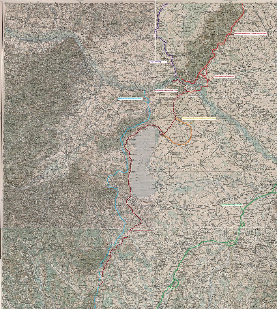
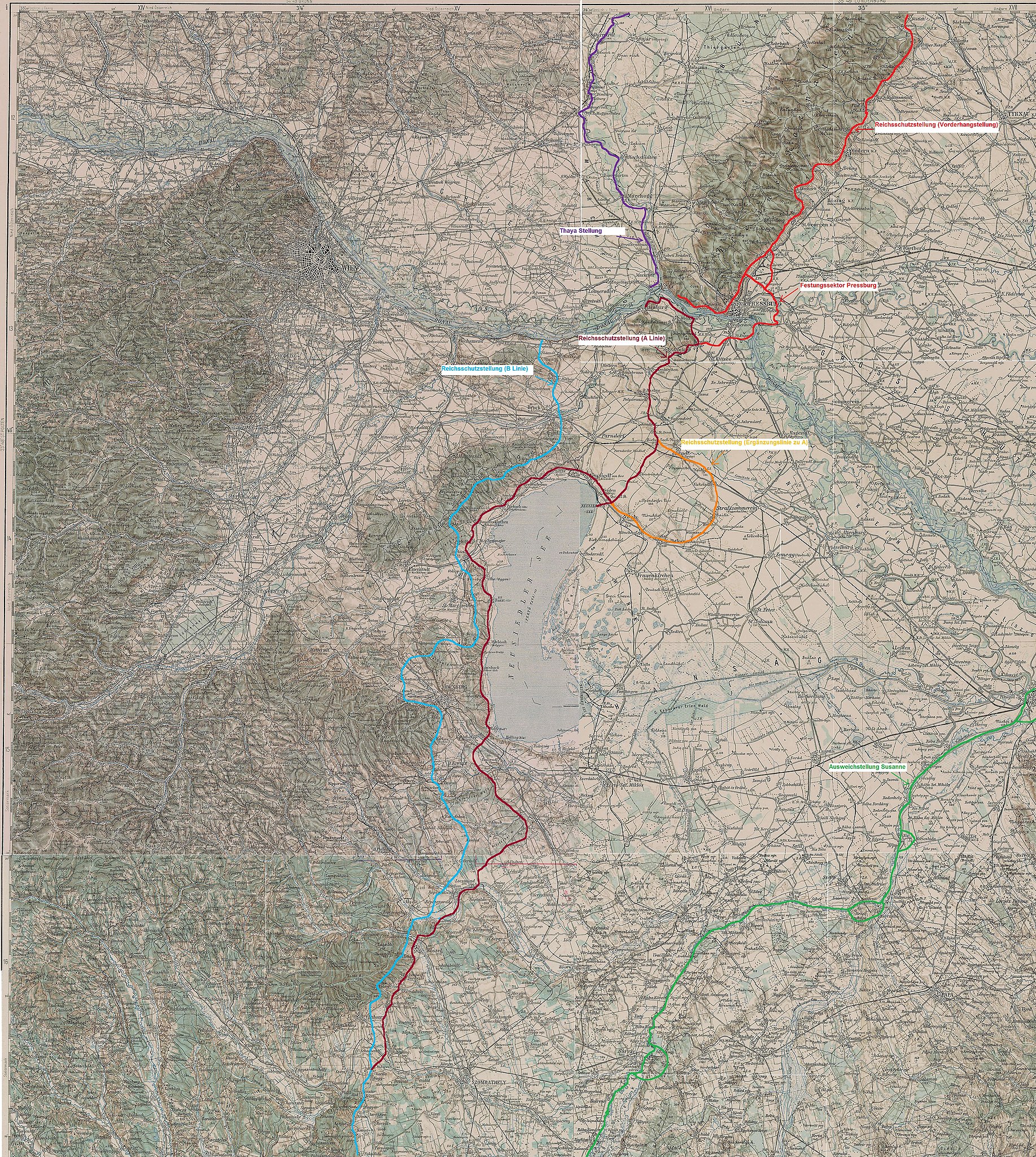
English: Fronline map ww2 marked in by myself on basis of a map from the 3rd Military Mapping Survey of Austria-Hungary |
| Datum | The original sheets were published about 1910 |
| Quelle | http://lazarus.elte.hu/hun/digkonyv/topo/3felmeres.htm |
| Urheber | 3rd Military Mapping Survey of Austria-Hungary in 1910 |
Lizenz
|
Dieses Werk ist gemeinfrei, weil seine urheberrechtliche Schutzfrist abgelaufen ist. | |
| Es wurde festgestellt, dass diese Datei frei von bekannten Beschränkungen durch das Urheberrecht ist, alle verbundenen und verwandten Rechte eingeschlossen. | |
Dateiversionen
Klicke auf einen Zeitpunkt, um diese Version zu laden.
| Version vom | Vorschaubild | Maße | Benutzer | Kommentar | |
|---|---|---|---|---|---|
| aktuell | 18:49, 28. Sep. 2010 | | 5.910 × 6.596 (12,83 MB) | commons>Mullerkingdom | {{Information |Description={{en|1=Fronline map ww2 marked in by myself on basis of a map from the 3rd Military Mapping Survey of Austria-Hungary}} |Source=http://lazarus.elte.hu/hun/digkonyv/topo/3felmeres.htm |Author=3rd Military Mapping Survey of Austri |
Dateiverwendung
Die folgende Seite verwendet diese Datei: